Where Is Alentejo Located In Portugal?
Where the Alentejo region sits in Portugal, how it is divided, and how Évora, its inland historic capital, connects to Lisbon and the rest of the country.
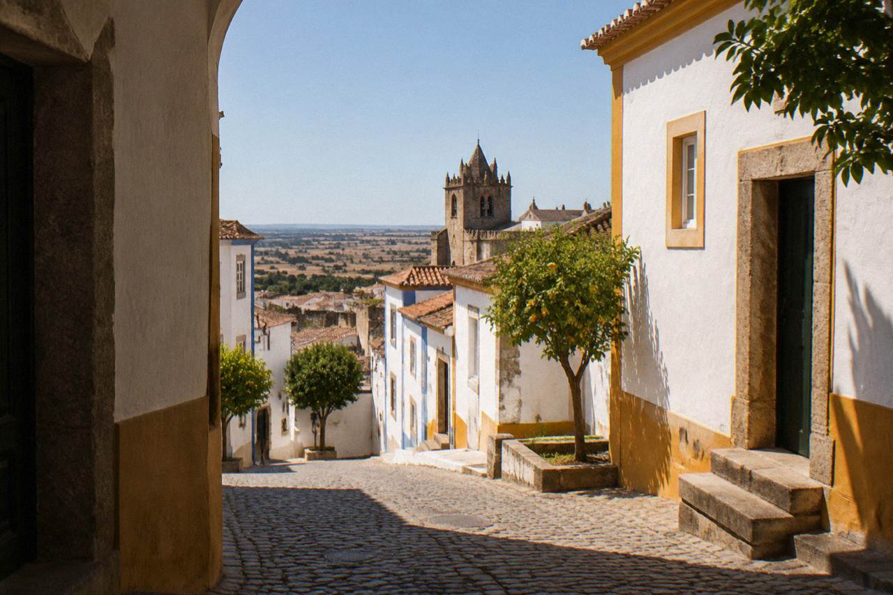
Évora, the capital of the Évora district and of the Central Alentejo sub-region, stands on an inland plain in southern Portugal, and the region around it is the Alentejo: the broad belt of country that runs from the Tagus river down to the Algarve and east to the Spanish border. The name is usually explained as "beyond the Tagus", a plain description of where the region begins once you cross the river south of Lisbon. This page answers the question of where exactly the Alentejo sits, how it is divided, and how its historic capital fits into the map of Portugal.
Where Is Alentejo Located In Portugal?
The Alentejo is the large southern region of Portugal that lies between the Tagus river in the north and the Algarve in the south, with Spain along its eastern edge and the Atlantic coast to the west. It covers roughly the middle third of the country's south, and Évora, its principal inland city, sits about 130 km from Lisbon in the region's central sub-region. The region is landlocked in character: plains, cork oak, wheat fields and low hills, not coastline.
Portugal's map falls into a handful of large regions, and the Alentejo is the widest of them. To its north lie the Lisbon area and the Centro region; to its south the Algarve, the country's tourist-facing southern coast. To the east the region runs along the border with Spain, the Spanish regions of Extremadura and Andalusia just across the Guadiana river. To the west the Alentejo does touch the Atlantic, between the Setúbal peninsula and the Algarve, with the long beaches of Comporta and Sines, but the heart of the region, where Évora stands, is deep inland. The Atlantic is roughly 90 km from Évora, and the city's character is entirely that of the plain: hot, dry, wide-skied, agricultural.
Administratively the Alentejo is split into sub-regions, and Évora is the capital of both the Évora district and the Central Alentejo sub-region. The other sub-regions carry names a visitor will meet on road signs and wine labels: the Alto Alentejo to the north and east, around towns like Estremoz, Elvas and Portalegre; the Baixo Alentejo to the south, around Beja; and the coastal strip that includes the Alentejo Litoral. The municipality of Évora counted about 53,000 residents at the 2021 census, which makes it the region's main urban centre alongside Beja.
For travellers the region's position is its main practical advantage. Lisbon is the gateway airport for almost everyone, and the Alentejo begins barely an hour inland from it. The Évora Travel Guide covers the city at the region's centre; for the wider picture the Alentejo travel guide walks through the region as a whole, and what the Alentejo is famous for lists what draws people there.
How Far Is Évora From Lisbon And The Region'S Main Towns?
Évora lies about 130 km by road from Lisbon, in the Central Alentejo, and the other main towns of the region spread out around it: Arraiolos about 20 km away, Estremoz about 45 km, Vila Viçosa about 60 km, Elvas about 80 km and Marvão about 120 km, with Monsaraz about 40 to 45 km to the southeast. All of these are rounded road distances, and every one of them is reachable on a day trip from the city.
The train is the easiest way in from the capital. CP's Intercidades timetable, valid since 6 September 2026, lists six through trains a day from Lisboa Oriente to Évora, taking about 1 hour 40 to 1 hour 45, with a second-class fare of 13.90 EUR and first class at 18.50 EUR. The trains call at Entrecampos, Sete Rios, Pragal, Pinhal Novo, Vendas Novas and Casa Branca before reaching Évora. Check the current CP timetable before travel, since departure times shift with each timetable revision.
The table below gathers the rounded distances a visitor actually plans around. Every figure is approximate and meant for orientation, not navigation.
| Place | Direction From Évora | Rounded Distance | What It Is Known For |
|---|---|---|---|
| Arraiolos | Northwest | About 20 km | Handmade needlework carpets |
| Monsaraz | Southeast | About 40-45 km | Walled hill town over the Alqueva lake |
| Estremoz | Northeast | About 45 km | Marble quarries and a medieval castle |
| Vila Viçosa | East | About 60 km | Ducal palace and marble townscape |
| Elvas | East | About 80 km | Star-shaped fortifications, UNESCO listed |
| Marvão | Northeast | About 120 km | Mountain-top walled village |
| Lisbon | Northwest | About 130 km | National capital and main gateway airport |
Because the region is a spread of small towns rather than one corridor, most visitors base themselves in Évora and radiate outward. The three days in Évora and the Alentejo itinerary and the Alentejo road trip guide both work on that pattern, and the question of how much time you need in Évora depends mostly on how many of these towns you want to fold in.
What Does The Alentejo Look And Feel Like On The Ground?
The Alentejo is a region of open, gently rolling plains dominated by cork oak and holm oak woodland, wheat fields, olive groves and vineyards, with hot dry summers and mild wetter winters. IPMA's 1991-2020 normals for the Évora station show a July mean maximum of 33.3 C and an August mean of 33.5 C, with 31.9 days a year reaching 35 C or more. It is landscape on a horizontal scale, with wide skies and long sightlines.
The climate numbers explain the region's rhythms better than any description. Rain falls in a clear winter half-year: the same normals give October through December between 81.5 and 86.0 mm of rain each, against 2.7 mm in July and 6.0 mm in August. The hottest temperature on record for the Évora station is 45.4 C, set on 4 August 2018. Summer visits are early-morning and late-evening affairs; spring and autumn carry the comfortable middle ground, which is why the question of which month is best to visit the Alentejo has a fairly clear answer.
| Month (IPMA 1991-2020, Évora station 558) | Mean Max (C) | Mean Min (C) | Rain (mm) |
|---|---|---|---|
| January | 14.1 | 4.5 | 68.6 |
| April | 20.7 | 8.5 | 62.1 |
| July | 33.3 | 15.6 | 2.7 |
| October | 24.1 | 12.3 | 81.5 |
The landscape is not empty, though it can look it. The cork oak woodland, the montado, is a working landscape that produces Portugal's cork, and the region's wines, olives and wheat all come off the same plain. The Alentejo cork and cork oak guide and the Alentejo wine guide cover the two products most visitors encounter, in the shops and on the table. The region's food runs to pork, bread soups, lamb and cheese, and the Alentejo food guide is the practical companion to a restaurant menu.
Why Does Évora Sit At The Centre Of The Region?
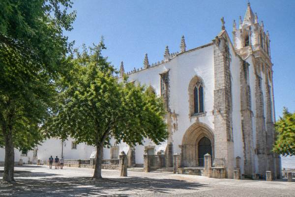
Évora has been the Alentejo's administrative and cultural capital for centuries because geography put it on the crossroads of the routes between Lisbon, the Spanish border and the south, and its walled historic centre, inscribed by UNESCO in 1986 under criteria (ii) and (iv), preserves the golden-age Portuguese city the 1755 earthquake destroyed in Lisbon. The city is the region's transport hub, university town and monument base in one.
UNESCO's criterion (iv) wording calls Évora the finest example of a city of the golden age of Portugal after the 1755 Lisbon earthquake, an earthquake Évora was largely spared. The listed centre carries Roman remains, including the Templo Romano, popularly called the Temple of Diana, which the municipal page says was probably dedicated to the imperial cult rather than to the goddess; Moorish rule in the city ended in 1165, and the Jesuit University of the Holy Spirit dates from 1553, with the Jesuits expelled in 1759. That layered history is why the city, rather than any of the region's other towns, is the base most visitors choose.
The practical side follows the historic one. The city holds the region's main railway station, its densest concentration of hotels and restaurants, and the ticketed monuments that anchor a visit: the Sé de Évora, with one complete-visit ticket at 5.00 EUR covering cathedral, cloister, roof terrace and museum; the Capela dos Ossos at the Igreja de São Francisco, with a 7.00 EUR adult museum ticket; and the Museu de Évora at 8 EUR, closed Mondays. The Évora Ticket, a multi-site pass, costs 8 EUR for one day, 10 EUR for two and 12 EUR for three, though it does not include those three headline monuments.
How Do You Travel Around The Alentejo Once You Are There?
Most travel within the Alentejo is by car or by guided tour, because the region's towns are small and scattered across a plain and the rail network only serves a few corridors: Évora sits on the Lisboa to Évora Intercidades line, and onward connections into the deeper region are limited. A visitor without a car typically bases in Évora, uses the train from Lisbon, and reaches the surrounding towns through day tours rather than public transport.
The guided options cover the main patterns well. A private skip-line walk such as the Évora University, Cathedral & Bones Chapel tour with wine tasting, from $91.39 per person and rated 5 from 48 reviews, handles the city itself in about three hours. Outward, the Megalithic and Cork Forest guided tour from Évora, from $50.65 per person and rated 4.9 from 41 reviews, reaches the Cromeleque dos Almendres and the cork landscape in four hours, and the Évora Tales and Legends guided walking tour, from $52.90 per person and rated 4.8 from 40 reviews, covers the historic centre's stories in two and a half. For the region's further towns, the best day trips from Évora and the individual town guides under the day-trips section lay out the options, always with the caveat that a car or a tour is the realistic way to reach them.
Driving is straightforward: the A6 motorway runs from Lisbon to near Évora and on toward the Spanish border at Elvas, and the IP2 threads north-south through the region. The Évora parking guide and the Évora car rental guide cover the two practical questions that follow. Cyclists and walkers should plan around summer heat and long distances between services; the plain is generous with scenery and short on shade.
Is The Alentejo Worth The Trip From Lisbon?
The Alentejo is one of Portugal's most rewarding regions for travellers who want history, food and landscape without coastal crowds, and Évora alone, a UNESCO-listed city about 130 km from Lisbon reachable by a 1 hour 40 minute train, justifies the journey. The question of whether the region is worth visiting has a short answer for most travellers: yes, especially for a first taste built around the city and one or two of the surrounding towns.
The honest framing is that the Alentejo is quiet by design. Its towns are small, its pace slow, its appeal concentrated in a handful of things done very well: monuments, wine, food, and the plain itself. Visitors comparing it with the Algarve or with Sintra should know they are choosing breadth of landscape over density of sights. The Alentejo tour from Lisbon option suits anyone who wants the region without organising transport, and the coastal day trip to Comporta and the Alentejo coast shows the region's one stretch of Atlantic shoreline.
Common Questions About The Alentejo'S Location
Where is alentejo located in portugal?
The Alentejo occupies southern Portugal between the Tagus river in the north and the Algarve in the south, with Spain along its eastern border and the Atlantic to the west. Évora, its main inland city, sits about 130 km from Lisbon in the Central Alentejo sub-region.
What does Alentejo mean in Portuguese?
The name is usually explained as "beyond the Tagus", referring to the land south of the Tagus river. The meaning of the word Alentejo is covered in its own answer.
Is Évora in the Alentejo?
Yes. Évora is a city and municipality in the Alentejo region, the capital of both the Évora district and the Central Alentejo sub-region, and the region's principal historic and university town.
Does the Alentejo have a coast?
Yes, along its western edge between the Setúbal peninsula and the Algarve, including the beaches around Comporta and Sines. But the heart of the region, including Évora, is inland: the Atlantic is roughly 90 km from the city.
Which countries border the Alentejo?
The Alentejo borders Spain to the east, across the Guadiana river and the land border with Extremadura and Andalusia. Within Portugal it is bordered by the Lisbon region and the Centro region to the north and the Algarve to the south.
The Alentejo is Portugal's wide middle country, and Évora is the city to aim for first: inland, UNESCO-listed, an easy train ride from the capital, and the natural base for everything the plain around it holds.